After the historical flood of 2019 here in Midwest, we are looking closely at how the local rivers behave, and thinking what is in store for the spring 2020 for us. While the National Weather Service has been doing a great job in producing the Flood Outlooks and informing the community about the potential scenarios during the public meetings, there are numerous unknowns that can significantly affect the way the situation will unfold as we go into spring.
What we know?
There is almost no doubt that the flood risk for the Missouri river basin (as well as for some other areas of course – but I will focus on my local area here) is above average. That means that flooding will occur to some extent – the question is where and when, and how bad it will be. Among the most important factors that will weigh on the potential severity of the upcoming floods are the amount of precipitation that the areas feeding into our rivers will receive, and the dynamics of snowmelt upstream.
Already happening
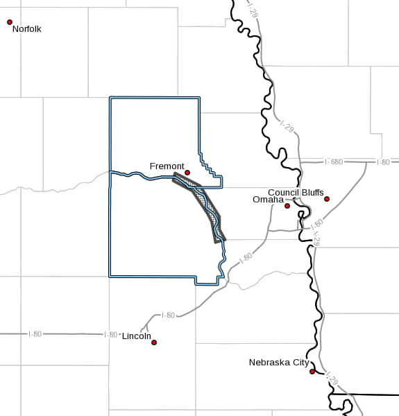
Even though this winter was significantly milder that the previous one (at least so far!), localized flooding started to occur relatively early. As the temperatures started climbing up, ice jams became an issue. Thus, one of them caused closure of Hwy 275 up around Scribner, NE, about 2 weeks ago. After that, situation unfolded downstream: a new jam formed last Saturday south of Fremont, NE, and led to flooding of property located near the river. Water level was quickly rising, and not everyone was able to clear their residences in time during voluntary evacuation. A water rescue had to be performed by the Waterloo Volunteer Fire Department – a dangerous, but successful operation that saved two lives.
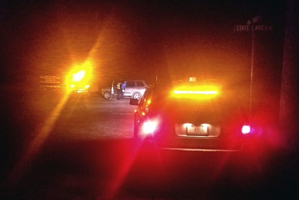
Emergency volunteer teams were also called for help, and provided support in river monitoring, traffic control, etc, while professional first responders were performing evacuations and rescues. After being extensively involved in the response efforts from the very first hours of the flood last spring, we were ready to help once again. It is important for trained volunteers to have trusted working relationships with local emergency management and first responders.
Later on Saturday, water levels started to go down, but the situation is expected to remain unstable for the next at least several days, since the ice jam still remains in place. Several roads remain closed in the affected area.
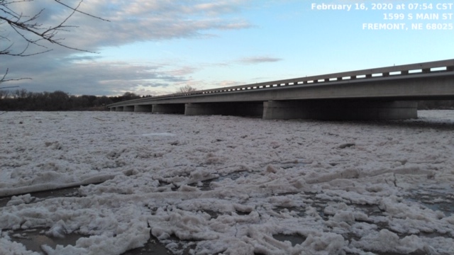
In fact, the ice jam-related flooding continued to develop further downstream. Earlier this morning, the NWS Omaha/Valley issued a Flood Advisory concerning the localized flooding around the Hwy 64 bridge over the Platte River. The water level reached the peak around noon, and has been falling since then. However, the upcoming colder weather will help the ice to stick around, thus water levels around the jam will be unstable for at least next several days.
What’s next?
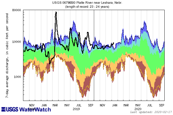
Looking at the current river levels (see the slider below), one can see that all three major water arteries of the Omaha area are running very high (bold black line represents current levels). While most of the snow melted around here, winter is not over yet, and several rounds of wintry precipitation are still expected. In addition, the Dakotas received well above average snowfall this winter again, that will eventually end up in Missouri river.
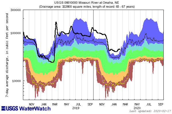
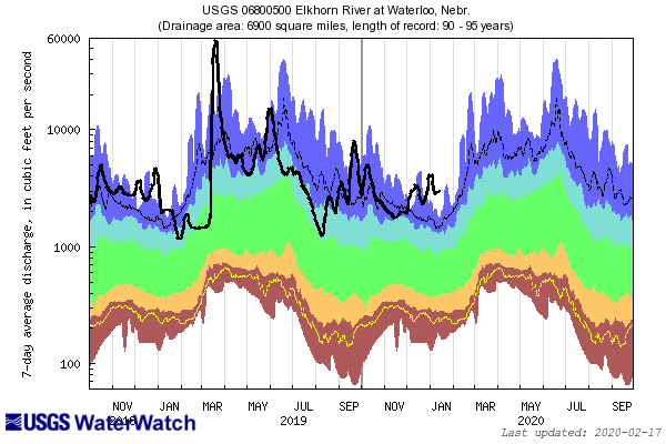
Together with the soil that is 100% saturated (and has been there for the most of 2019), water from melting snow – and later from spring rains – doesn’t have anywhere to go except to the runoff to local creeks and rivers. The only hope short term is that precipitation will be spread evenly in spring, with no major weather events amplifying the threat (like the “bomb cyclone” of March 13, 2019). In the mid-term, a drier summer would help the remaining water to absorb into the ground, and hopefully set a better baseline for the flood-less 2021!