Earlier on this trip:
After a good quiet night at the Lake Mac, we woke up early to head north to South Dakota. We looked forward for a busy day, as we had 300 miles to drive, we planned a stop with a tour along the way, and we wanted to arrive at our destination before dark to set up the camp. Thus, we had a quick but hearty breakfast, packed the car, said goodbye to the lake and hit the road.
Driving from the Lake McConaughy north into South Dakota, through the most picturesque parts of Nebraska Sandhills and the Nebraska National Forest, you have an opportunity to appreciate the variety of landscapes across the state. Turns out that Nebraska is not at all table flat as some people think (although it truly is in the middle of the state).
Coming to Black Hills region, you find yourself in a spot where state and national parks are abundant, and the variety of natural landmarks really puzzles you with the question: what should I see if I only have so much time? On our way to the campground, we decided to make a stop at the Wind Cave National Park – home of the world’s 7th largest cave (as of now), with over 150 miles of explored passageways. It is the seventh national park in the US, and the first cave to be designated as a national park.
There are several tours that are offered in the cave. Some standard tours are more frequent, accommodate more people in the group, and give you more chance to get in right away. Specialty tours, however, have to be booked in advance. We ended up going on a Fairgrounds Cave Tour, which I found very informative. It took us through most of the unique features that the Wind Cave is known for, particularly the boxwork. However, even the standard tours can sell out quickly on a busy day: we were lucky to get the last tickets approximately 40 minutes before the tour, otherwise we risked to leave the park empty-handed.
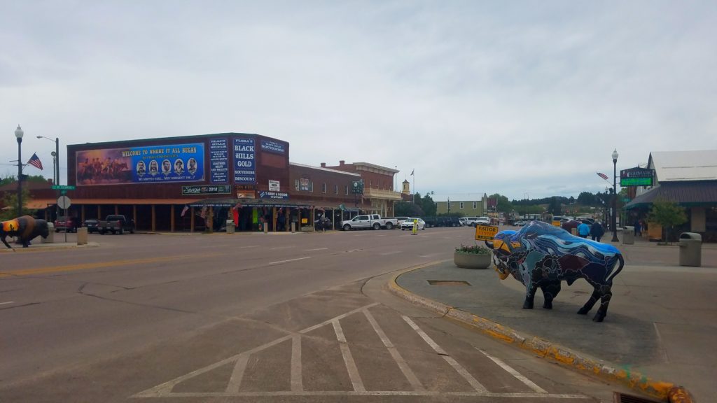
After the tour was over, and we saw the first ray of sunlight again (which happened only occasionally during the day, as the weather was changing quite rapidly), two major thoughts occupied our minds: how awesome, complex, and beautiful in its own way the cave was, and is it legal to hunt a bison right now because we were definitely ready to devour the whole animal and still have room for a dessert. Thus, we stopped at Custer on our way to introduce ourselves to bison burgers – one of the local specialties.
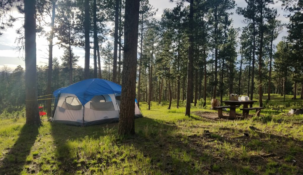
One of the things I like the most in being on the road is that surrounding scenery constantly changes, feeding all your senses will new sights, sounds and smells. From where we left, we drove through flat plains and corn fields, beautiful sandhills, forests, and finally came to the mountains. This was my very first thought when I got out of the car once we made it to our campsite: the magic cocktail of fresh air with distinct notes of pine oils, long shadows of ponderosa pine trees lit by the sun rolling towards the horizon, and silence. I wanted to come here for a long time, and now I knew exactly why!
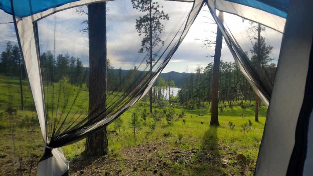
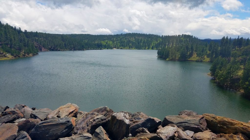
There are several campgrounds in Black Hills – in fact, there are three of them only at the Deerfield lake. I chose this lake as it is located in the very heart of the Black Hills National Forest, somewhat higher than most of other campgrounds, but also in a more isolated area farther from the civilization. The Dutchman Campground appealed to me with its location on the south shore of the lake, and certainly with the fact that the campsites are located on the slope of the hill (hence better chance of a good view) and are very generously spaced. I’ll be honest – this is the most beautiful campground I’ve stayed in so far, and it offers the best spacing between the campsites, offering plenty of room and enough privacy.
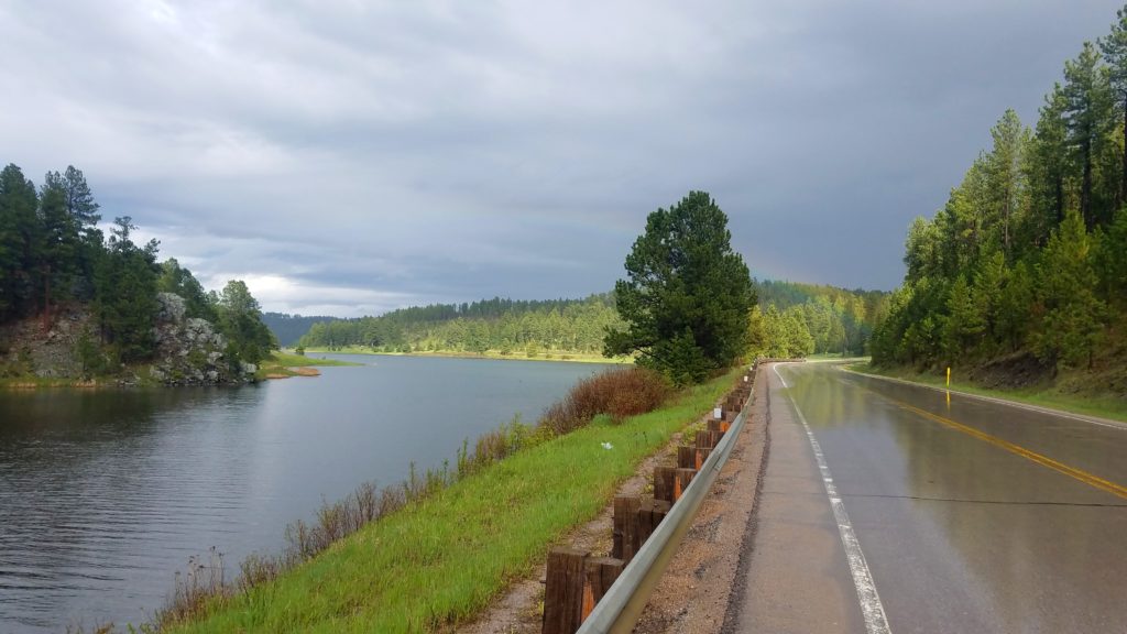
One of the important things that one has to keep in mind if you are planning to camp in Black Hills is, of course, weather. First off – it is colder here, which is certainly welcome to some extent, especially during those days of Midwestern summer when the temperature barely drops below 75-80 F at night. But in June in Black Hills, two out three nights we slept at 37 F – not critical, but certainly something to be ready for. Secondly – weather changes rapidly, and sometimes considerably. For example, during our second day there, there were at least 5 rounds of rain (various intensity too – from sprinkles to a decent downpour) followed by sunshine. So – I won’t say anything new here, but layers is your everything.
Next day after arrival, we decided to venture on quite a hike: even before leaving home, we read that there was a trail that goes around the Deerfield lake, and thought that this should be a great opportunity to explore the local area. Thus, in after breakfast and a quick session on the air, we entered the trail 40L – Deerfield Lake Loop Trail.
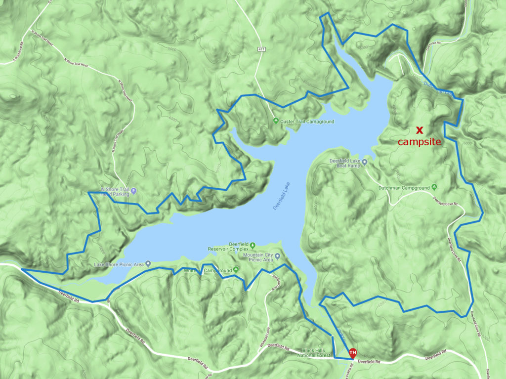
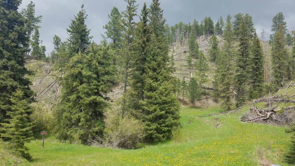
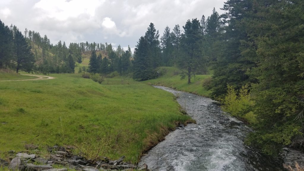
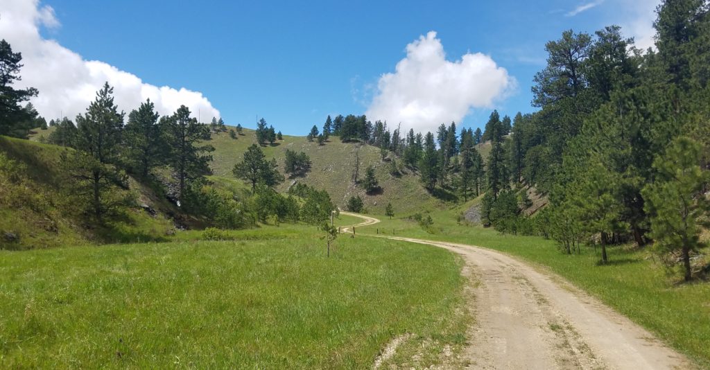
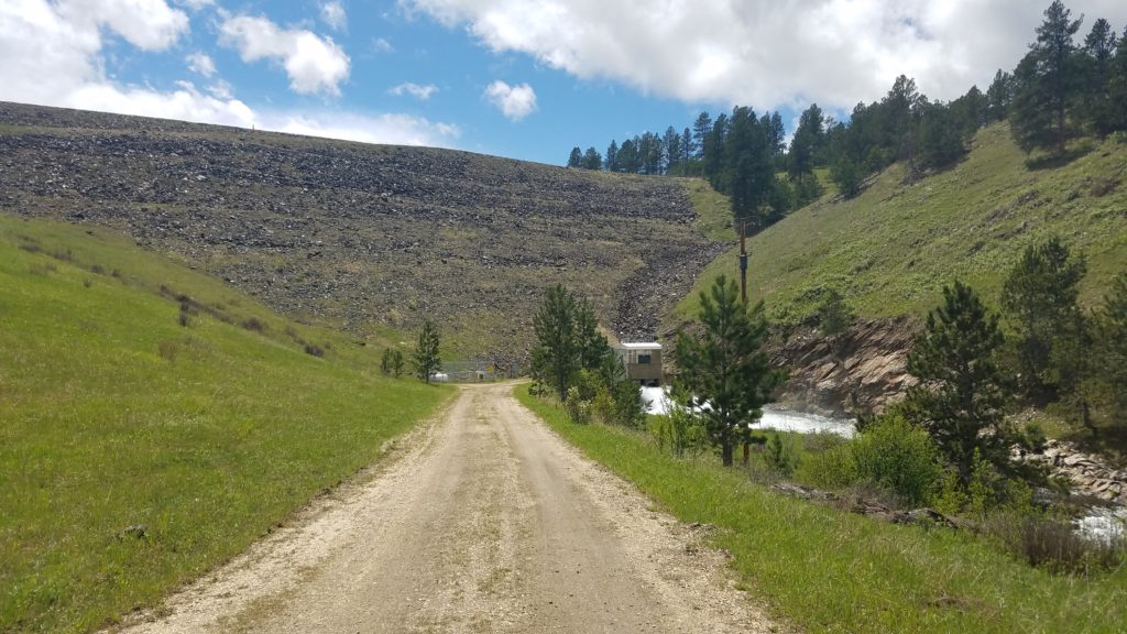
First stretch of the trail, going north from our campground, follows the Dutchman creek. One notable detail is quite some downed trees on the ground, some lying across the trail – the signs of quite snowy and active winter, and from I read later, those issues only persisted with abundant rains and mudslides later in June and July. Whenever we had to cross the creek – there was rarely a normal bridge, but rather a log or something similar, adding to the feeling that we are going through the obstacle course. And, to be honest, this course was not well marked either: thus, we made a turn to continue along the creek all the way to the dam, hiked up to the dam and proceeded further north – only to realize that we should have crossed the Dutchman Rd to climb uphill from there.
However, we were rewarded for this little diversion from the route by a beautiful panorama of the lake looking from the top of the dam. Boy, was it windy up there!
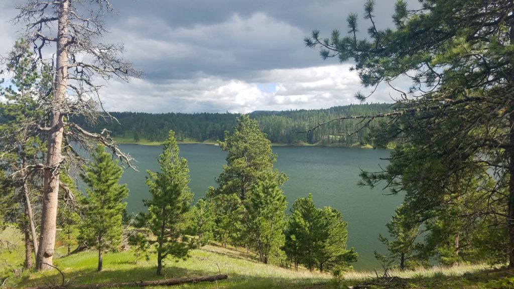
Once we finally got to the normal route, we continued out hike along the north shore of the lake. On this part, the trail goes up and down quite a bit. As this area is also used by the ranchers for cattle, thus there are several gates along the path. Most of them can be opened (and please leave them as you find them), but we had to jump over the fence a couple times. A nice hike overall, but I expected more views of the lake, thus I had mixed feelings about the trail. A decent portion of the hike goes through the prairie or the woods – however, sometimes you come almost right to the lake, and the path can be somewhat impacted by changing water levels.
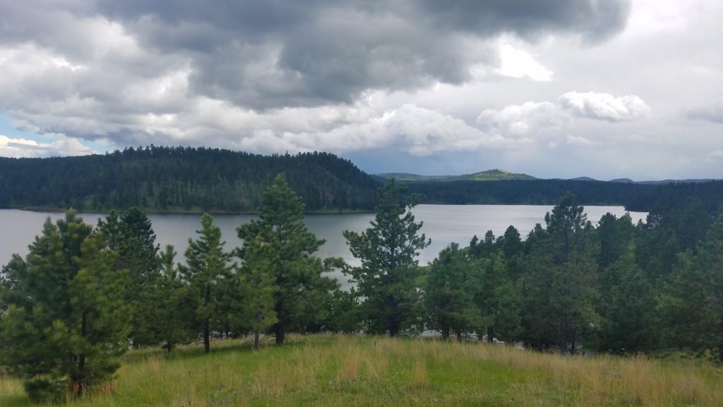
By the time we started our descent to the Deerfield Rd on the west side of the lake, a thunderstorm accompanied by a pretty heavy rain started, and we decided to stop and wait a little. When the downpour eased up, we proceeded to the road, re-evaluating our plans at the same time. With the path becoming significantly wet, and a significant part of the remaining trail along the south shore not even going along the lake, we decided to abort the mission and return back to the camp following the road. We did not win much in terms of elevation gain, but at least had good pavement along the rest of the way.
Overall, the hike took us approximately 6 hours, with all stops and detours, as we scored 14 miles across a pretty diverse terrain. The main take-home message: watch the weather closely, and know your trail before you start. With the elevation change along the entire trail reaching around 1700 ft it is not an easy one – but certainly a great walk for a long day. Just don’t forget to pack your lunch!
Later on this trip: